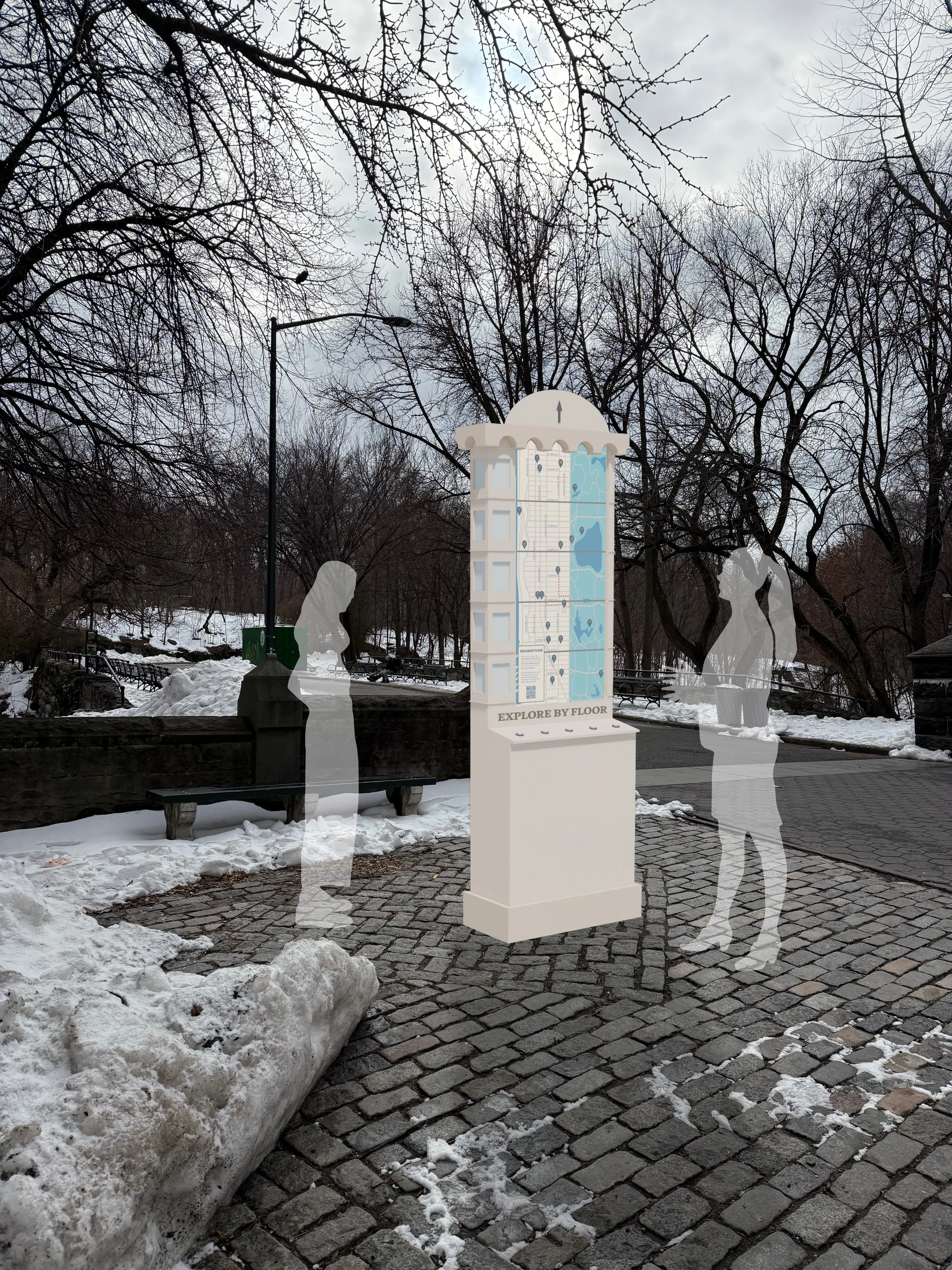
Explore by Floor
[Environmental Graphic Design]
Project Tasks:
Map Design
Concept Design
Graphic Development
Drawings
Tools:
Adobe InDesign
Adobe Photoshop
Adobe Illustrator
Rhino 3D
AutoCAD
Enscape
Title:
Explore by Floor
Project Brief
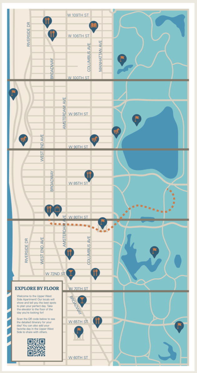
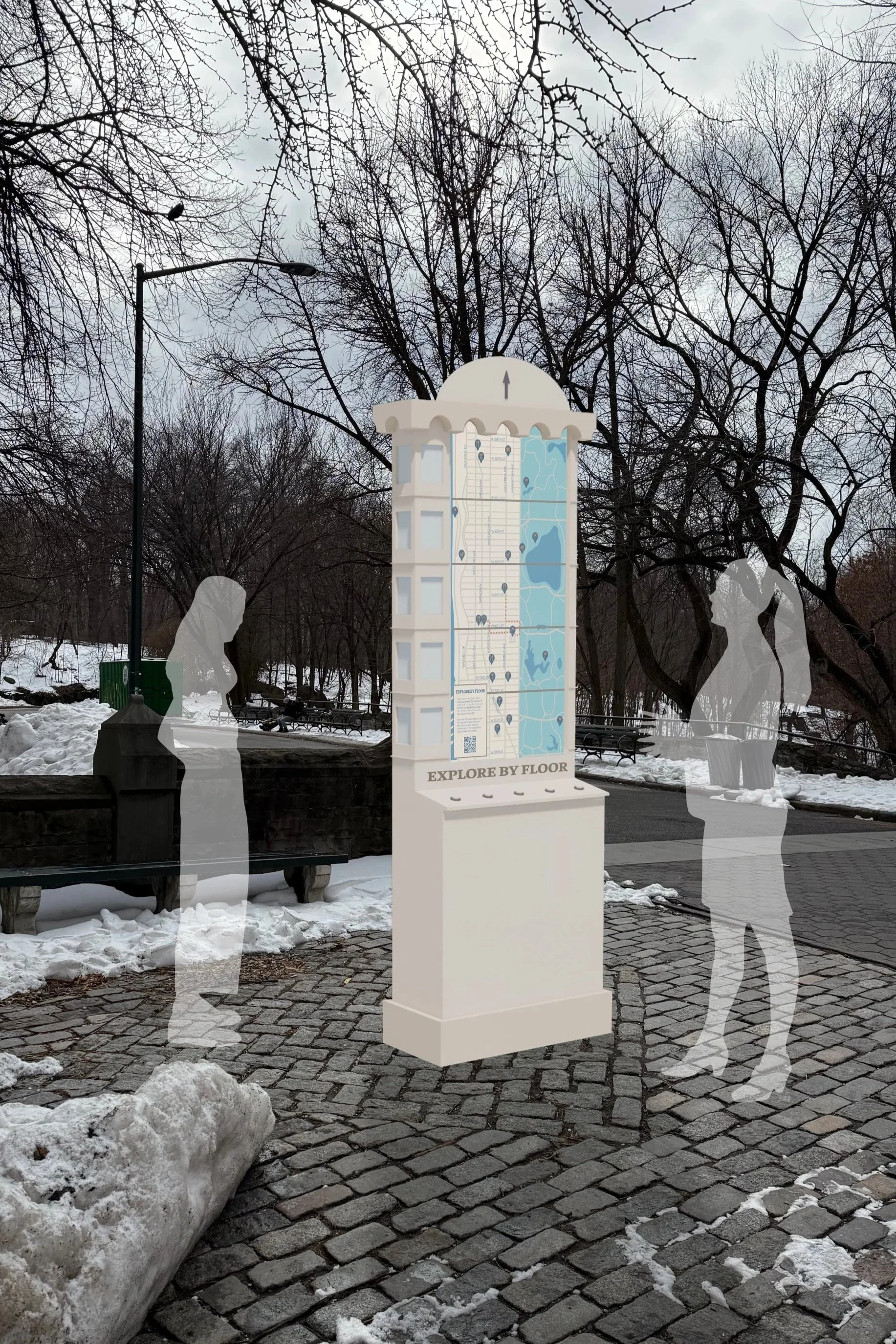
The goal of this project was to create a signage and wayfinding system for a neightborhood in New York City. With Upper West Side as my selected neighborhood, I designed a map system that is inspired by the apartment buildings found in the city and functionally gives visitors different itineraries based on what is most known in each section or “floor” of Upper West Side.
Selected Neighborhood: Upper West Side
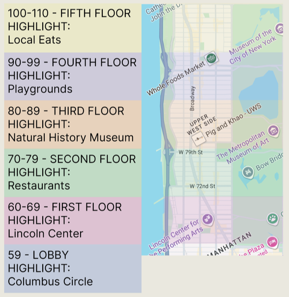
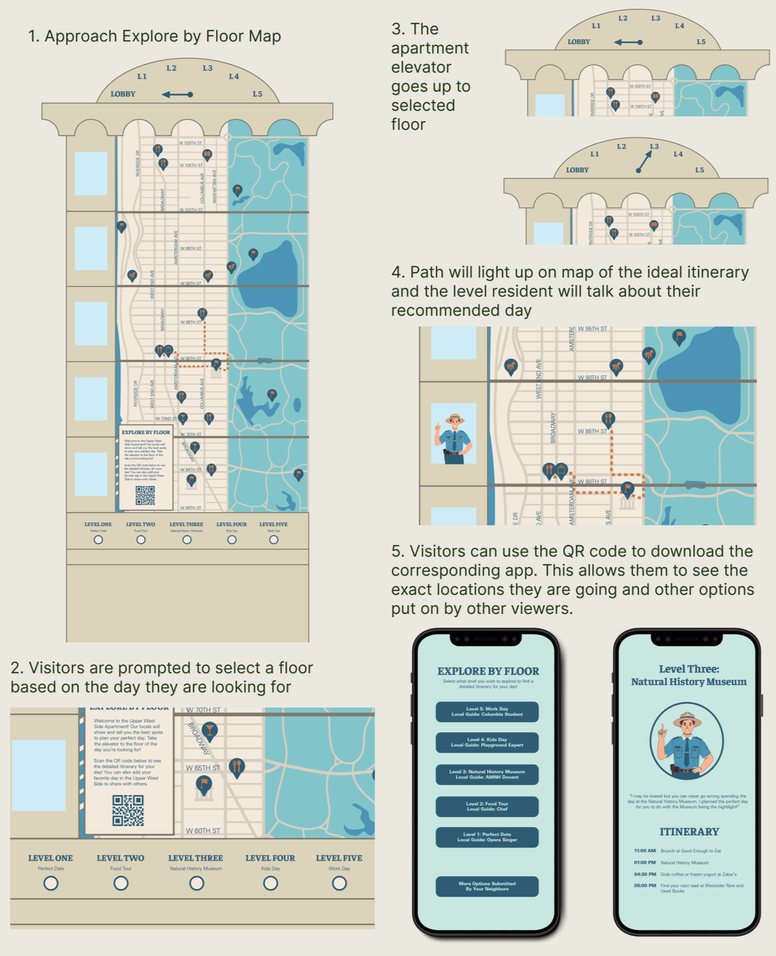
As the 3rd largest neighborhood in New York City, Upper West Side spans over 50 blocks between the Hudson River and Central Park. Though the spirit of Upper West Side spans across the neighborhood, there are micro-neighborhoods created by the communities that live within the different areas. This map dividesthis vertical neighborhood by every 10th block – creating levels that resemble the iconic residential apartment buildings found within New York City. It will give viewers a chance to explore and make a day out of exploring new areas of the neighborhood and show points of interest on the corresponding level of the park.
Big Idea
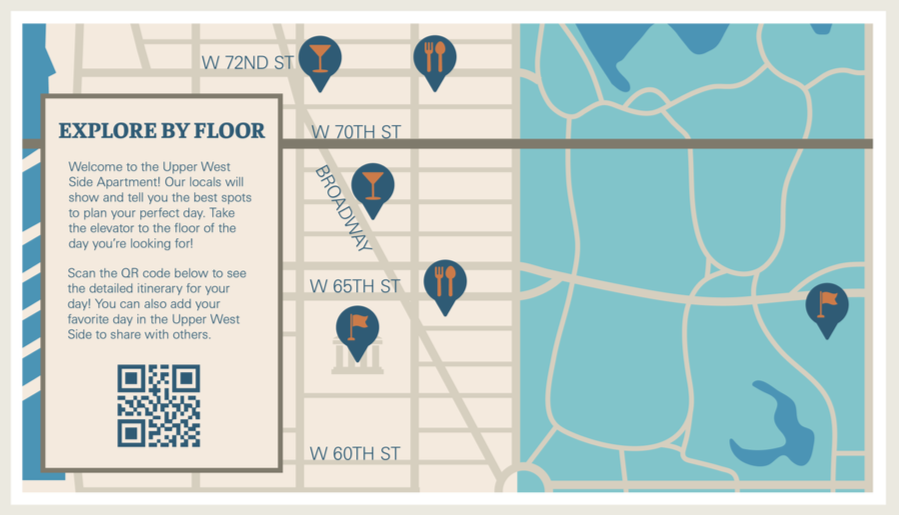
Explore by Floor guides visitors to explore the many parts of the Upper West Side. In this map system, Upper West Side is divided into the five floors of an apartment building, inspired by how the shape of the neighborhood resembles different floors. Local guides from each level will tell of their favorite spots to hit, giving visitors a guided itinerary depending on what fits their wants and needs for the day.
Concept Design
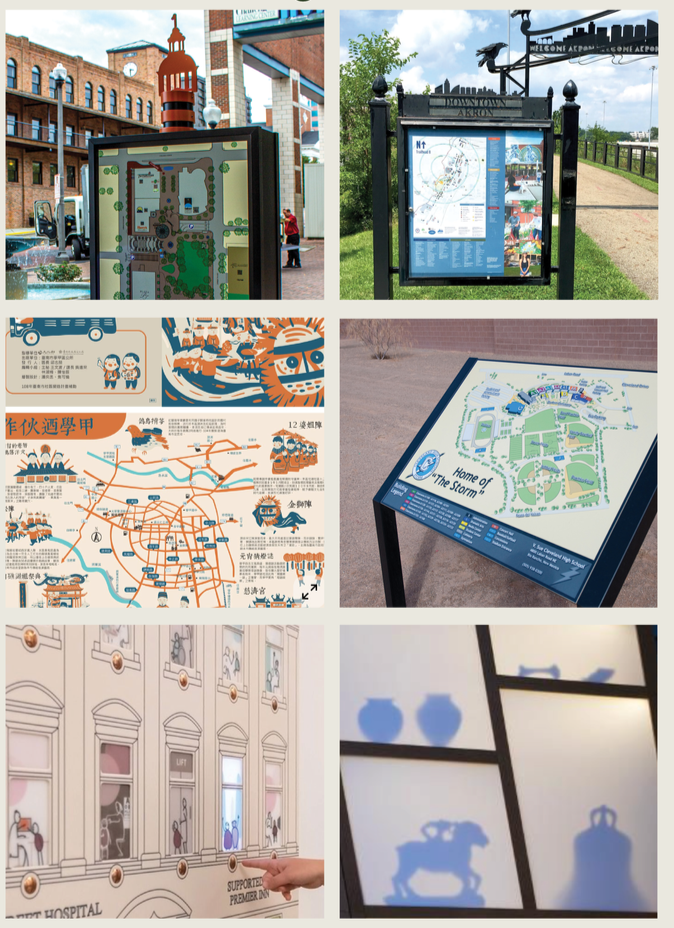
Reference Images
Graphic Development
Map Design
Design Details

Icons

Typography
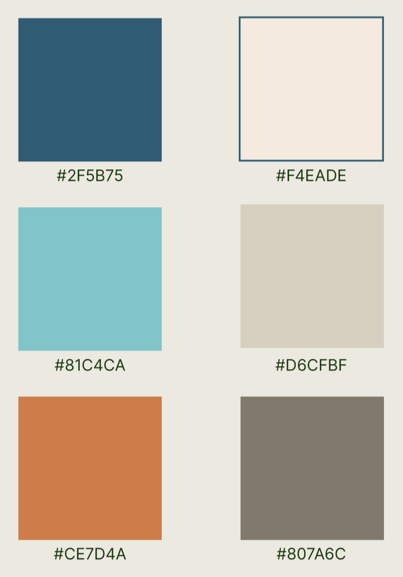
Color Palette
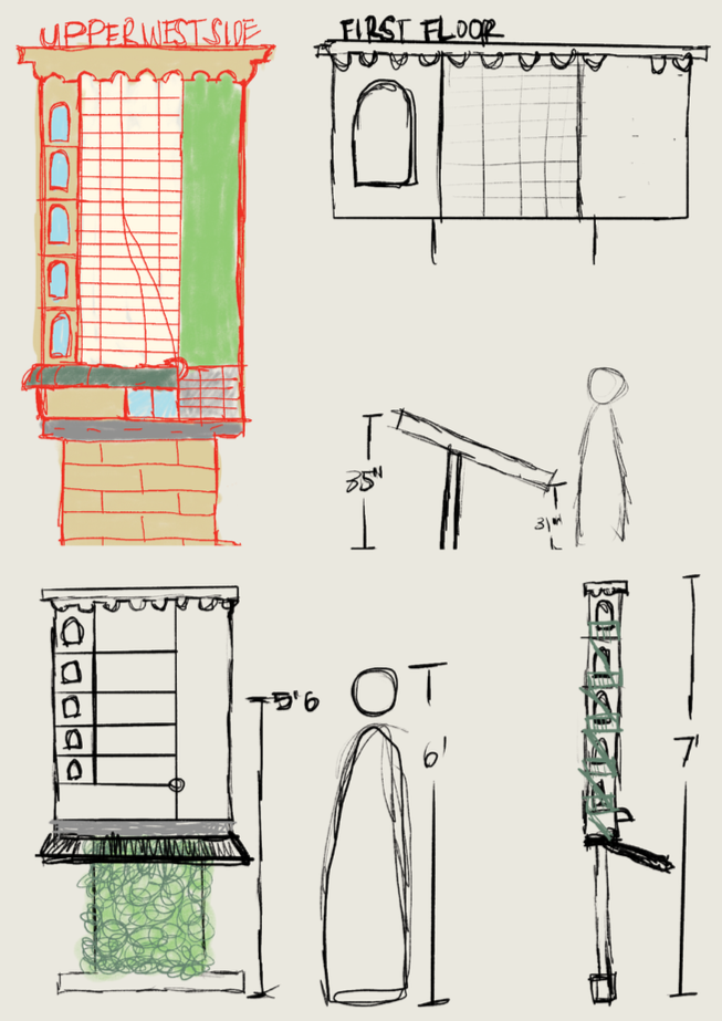
Sketches
Experience and Story Board
Structural Development
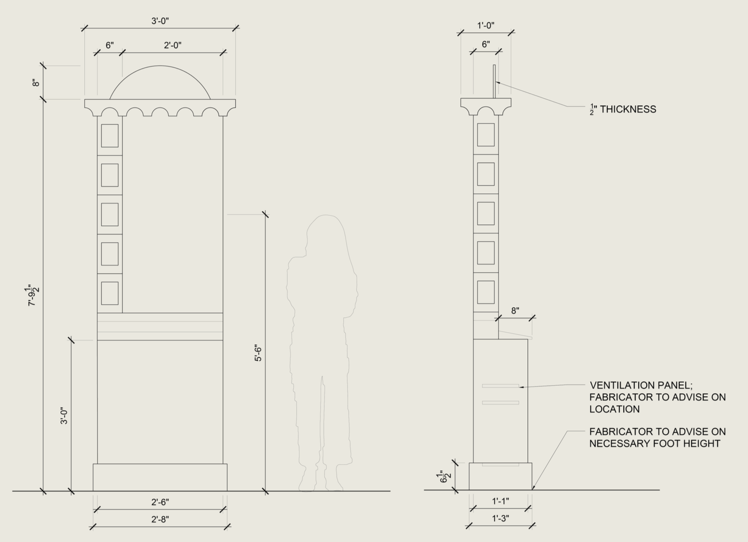
Materials
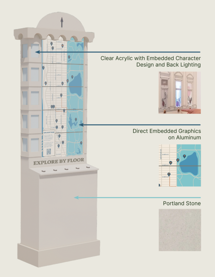
Front Elevation
Side Elevation